Wednesday, May 9, 2018

Draining the Swamp

The Great Dismal Swamp is a lovely place. Really. According to Wikipedia, William Byrd II was leading a land survey in the area in 1728, and he apparently had many not-so-nice things to say about his experience there. We have him to thank for naming it the Dismal Swamp. In the years since, it has become a National Wildlife Refuge, encompassing 112,000 acres of beautiful, forested wetlands.

(from the Dismal Swamp Welcome Center website, October 30, 2017)

The canal that cuts through the eastern edge of the swamp is an alternative route of the ICW, connecting the Chesapeake Bay with the Albemarle Sound in North Carolina. When we came down in the fall, the swamp canal had just reopened after a year-long closure due to damage from hurricane Mathew. The main route is called the Virginia Cut. It is also beautiful, but less wild, and it stayed open after the hurricane for boats to travel down the ICW. We thought we would be one of the lucky first vessels to go through the swamp after it re-opened, but then we did some online research. The canal had been dredged and was safe to traverse, but after so many months of inactivity, the surface of the water was covered in a heavy carpet of duckweed. Looking like algae from a distance, up close you can see that duckweed is actually made up of tiny leaves, making a thick green soup. You can get an overheated engine if the stuff clogs your water intake. The canal website showed scary pictures, and warned that the duckweed was the worst they had ever seen it. Sadly, we chickened out and took the Virginia Cut instead.

Duckweed

Since then, we’ve met up with other cruisers who had taken the Swamp route, and they all said that the duckweed was no big deal. Rick has decided that the way our boat is configured, with the cooling water intake mounted low on the hull and a good strainer on the water hose higher up, we will be okay too. While we aren’t completely sure of the status of the duckweed this spring, we’re determined not to miss out again on our way north.

Savannah

Walking tour with "Savannah Dan"


Charleston


Magnolia Plantation 

Magnolia Plantation
Awaiting  dinner at Husk

Myrtle Beach


Cyprus trees are KING in the low-country


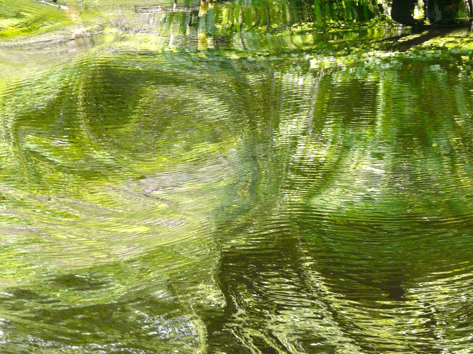
We’ve been steadily making our way up the ICW, stopping in Savannah, Charleston, and Myrtle Beach, SC. Along the way, Rick has started a driftwood-themed photography project:


Always the philosopher, Rick seems to be fascinated these days with death and decay. Very uplifting. He’s also been tempting fate by adding to his collection of boat disaster photos. Thankfully, his conspicuous enjoyment in creating this album of other peoples’ misfortunes has not resulted in any divine retribution involving a disaster of our own. At least, not yet.


After spending the night just north of Elizabeth City, NC, we are ready for our one-day trip up the Great Dismal Swamp Canal. As we head out early in the morning, we can see that any lingering fears about the duckweed are almost completely unfounded. After a winter of boating activity in the canal, the surface of the water is beautifully clear and glassy, the only duckweed relegated to the very edges of the canal. Everything is gloriously still, and even with the sound of our engine, we can hear the birds calling to one another.


We will encounter two locks today, one near the beginning and the other at the end, the bookends of the canal. Having only gone through one other lock aboard Valkyrie, last fall in the Virginia Cut, we’re still excited about the whole lock experience, and we don’t even try to hide our school-kid giddiness as we enter the area. We are definitely not the only ones feeling this way. The powerboat directly ahead of us is named Magic, and a member of her crew yells out to us, “Isn’t this AWESOME?!!!”


The lockmaster corrals us into place on the port side, and instructs us to hold on to our docking lines as the water rises. We will be rising up about eight feet, and the lines will need to be tightened on the way up. The lock gate closes behind us, and then water from the north side is allowed to slowly drain in while we float gently upwards. 


Just in case you were tempted...

Once we have risen enough to come even with the northern water level, the gate in front of us opens, and we move off into the canal and past the draw bridge, one by one. As we’re leaving, the lockmaster warns us, “Watch out, you may encounter some kayaks or canoes up ahead.” Okay, no problem.

“Some kayaks or canoes”????


It’s Paddle for the Border, an event for over three hundred participating kayakers, canoers, and paddle boarders, who are making their way along the Dismal Swamp Canal from South Mills, NC to Chesapeake, VA, where they will join up for a picnic lunch. This only happens one day out of the whole year, and lucky us, today’s the day! We pick our way through the throng, Rick at the wheel, and me on the bow, blowing Rick’s battered old moose horn to try and warn the paddlers of our approach. I may be a trained musician, but I am no wind player. My calls on this instrument sound more like a sick cow than a moose. But the people we pass are very good-natured about it all, asking what the heck is making that noise, and joking about hitching a ride with us.


The canal crosses the border between North Carolina and Virginia, and there’s a great two-sided sign on the east bank, letting you know which state you’re in. The Dismal Swamp Hotel was built on the west bank, completely astride that state line, at about the time the canal opened in 1805. This created some advantages for gamblers who frequented the place. If a sheriff arrived, they would simply move to the opposite side of the room, across the state line where the lawman had no jurisdiction. Sounds like a fun place, but sadly, that hotel no longer exists.

As we passed through the thicket of kayaks and canoes at their lunch spot turn-off landing, we promised to join them again next year, but hopefully on kayaks. Registration for the Paddle starts in January, and we were warned that it fills up fast, so if you’d like to meet us there, mark it down in your calendar!


We had the canal to ourselves once again, and it was smooth sailing (or motoring) up to the last lock. Then we re-entered the Chesapeake for the first time since last November. After anchoring in Portsmouth, VA, just south of Norfolk, we stole ashore for a celebratory dinner at the marina. It feels good to be almost home.


Tuesday, April 24, 2018

Running Amuck

Sailing out into the open ocean can be a scary proposition. Out of sight of land, and out of cellphone and internet range, the off-shore sailor can find him- or herself in an unexpected storm with nowhere to hide. Equipment failures, health crises, falling overboard - all nightmare scenarios for a blue water boater. But the one disaster you will thankfully almost never encounter while out in the deep blue sea is running aground.
Georgia ICW

The ICW is a set of protected waterways that are just inland of the Atlantic, made up of rivers, canals and inlets that provide a pathway north and south for traveling boaters. Many areas of this meandering snake are very shallow, particularly at low tide, and are maintained by the U. S. Army Corps of Engineers (USACE), who are mandated by law to cut through the low spots regularly to ensure a mean low depth of at least twelve feet. Because they don’t dredge the entire waterway, but only a very narrow channel, this results in a deceptively wide body of shallow water with only a thin cutout for boats to pass through, not unlike a very narrow two-lane country road. It’s not for nothing that the ICW is nicknamed “The Ditch” by boaters. The USACE is also in charge of checking the channel markers periodically and, if necessary, move them to reflect the latest shoaling of a constantly changing bottom. Unfortunately though, they don’t catch everything, and due to chronically low government funds for dredging, the depths are inconsistent. Things can change so rapidly that sometimes even updated charts are just woefully wrong.

A couple of weeks ago, we crossed over from the Bahamas to Florida, joining the ICW at Fort Pierce. Since then, we have been working our way north, looking forward to revisiting some of our favorite stops from our trip south, and hopefully discovering some new places as well. We spent a lovely Easter holiday in Vero Beach  - “Velcro Beach” to the locals, due to the hoards of boaters who travel down there and end up staying indefinitely. Leaving Vero behind, and looking to anchor in a little cove just south of New Smyrna, we suddenly found ourselves hard aground. True, we were off the beaten track, well off the “magenta line” that indicates the ICW route, but our chart plotter still showed that we had plenty of water under our keel. Clearly this wasn’t true.

Barely aground, still upright but stuck in the mud

No real reason to panic though; I have learned this by now. Just wait for the tide to come in and then you’ll float off. And we were intending to anchor here anyway, so not being able to go anywhere for a few hours was really not a big deal. Rick used the extra anchor, which has rope rode instead of chain, and ran it out in the dinghy to set it. He cleated it off at the stern so that he could later use the winch to help get us off the shoal. Then we had our usual evening routine of cocktails, dinner, and bed.


Around midnight or so, we were awoken by a reassuring rocking of the boat - we were floating free! But we were also completely turned around. Once the boat was released from the bottom, the current had swung it completely around, and since we were anchored from our stern, the anchor rode got all tangled up with our rudder. Oops. We started up the engine to turn us back around, but the rudder was so tightly wound with the anchor rode, we couldn’t go anywhere. We were going to have to untangle things by hand.

Rick always seems so cool in these circumstances, it’s easy to think that everything is effortlessly under control, no big deal. But this time, my mighty hero came a bit unraveled. It was the middle of the night, after a very long day of motoring, and he was exhausted. The lines he was trying to run weren’t cooperating. I was trying to help, but I just couldn’t understand his instructions, and of course that resulted in a predictable string of bickering between us. And then the damned dinghy motor stalled on him.

That’s when Rick just started maniacally laughing.

We had to do some fancy finagling to get it all unwrapped and re-secured from the bow, but it did work out in the end. Friggin’ charts.


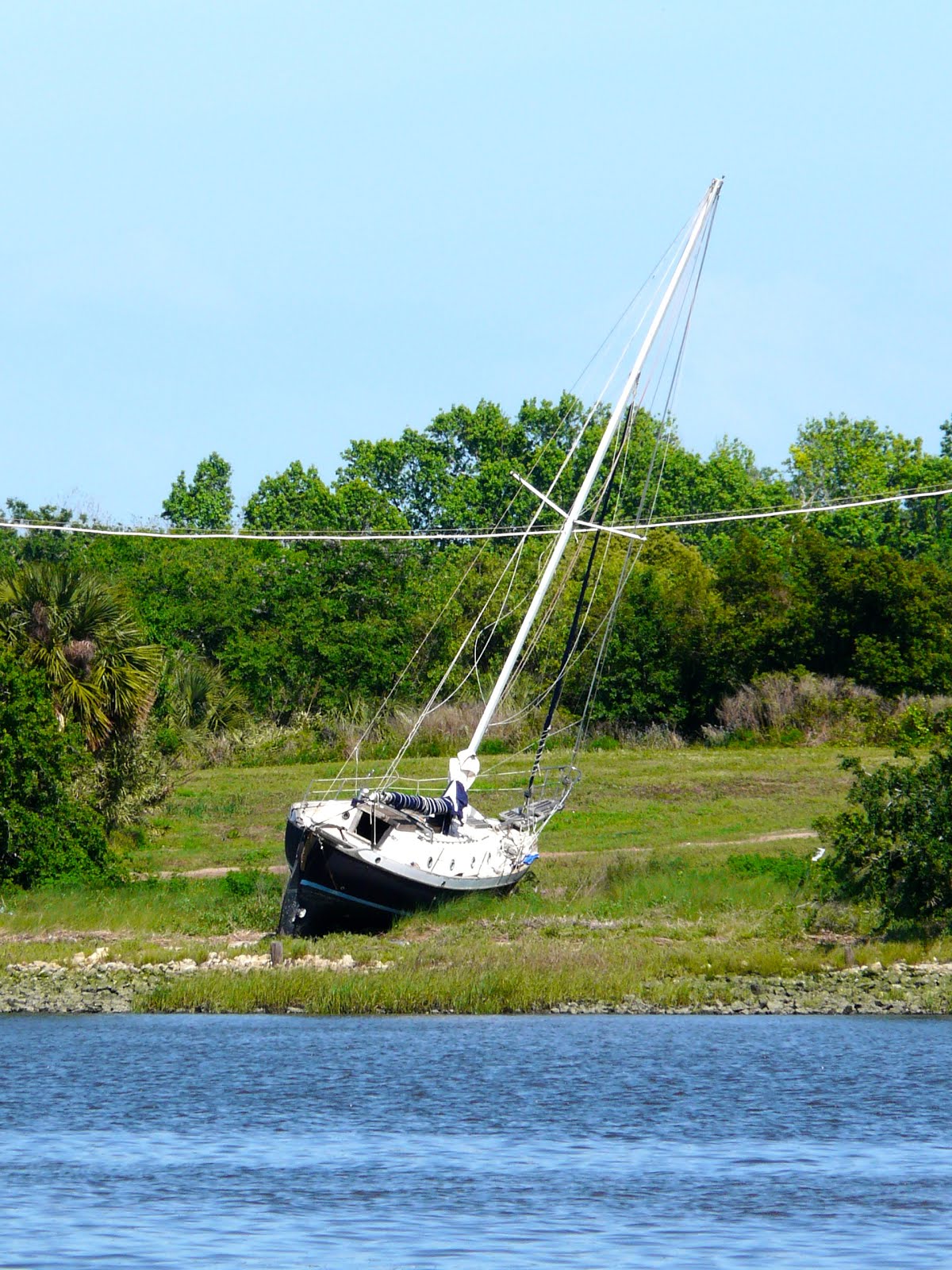
After a wonderful second-time-around visit to St. Augustine, we again headed north, knocking out thirty-five miles each day, averaging six to seven hours of steaming. The stretch from Florida’s northern border up through Georgia is particularly squirrelly, winding back and forth like a string of small intestines (try not to think too hard about that metaphor). This type of terrain, criss-crossed by strong tidal currents, makes a great recipe for shoaling, and sure enough, we noticed a number of abandoned boats on the way that had either run aground or succumbed to some other calamity. Rick has developed a morbid fascination with these wrecks, taking pictures of as many as he can so he can add them to his “collection”. He tells me that he sees each of them as an image of the human condition. I think it's just an intellectualized version of rubbernecking after a car accident. But what do I know?


Just south of Savannah, we saw a stellar example of the run-aground sailboat, high and dry on a sand bar, and Rick grabbed his camera to document it, handing me the wheel. The boat looked abandoned to me, but Rick was pretty sure the owners were still aboard. “Wow, how could they have misread their chart plotter so spectacularly?!!” we said to one another. I don’t know about Rick, but I was smiling to myself in that self-satisfied way, thinking how we would never have been that stupid. Oh Karma, why did you have to be paying attention? I was watching the chart carefully, sticking to that magenta line like glue, but somehow… something was off. The sand bar that held that forlorn vessel was directly in front of us. Rick came back to the cockpit and questioned my course, but I was adamant that I was doing just what the chart indicated. I was like the lady on the phone who insists that you don’t exist because, “that’s what it says in the computer.”


So, I bet you can guess what happened. Yup. We ran aground, only a couple hundred yards from the boat whose beaching we had been admiring. With the keel on Valkyrie, we draw five feet below the waterline, which means we need at least that much depth to stay afloat. Our chart plotter said we should be in twelve feet of water even at low tide. Our depth sounder read “3.4 Ft.” You do the math.


Why do you need a keel for sailing? Well, when the wind fills up the sail that’s attached to your mast, that same force from the wind will tip your boat completely over if you don’t have something to counter balance it. Hence the keel. Generally, the bigger the boat, the deeper and weightier the keel. Other designs work off of the same principle, just using a different method. The traditional Hawaiian outriggers, for instance, or the modern catamaran. No keel down below, but pontoons to keep the boat from tipping over by buoying up the leeward side (away from the direction of the wind).

Hawaiian Outrigger Sailing Canoe


If we owned a catamaran, we would obviously be much less likely to run aground, particularly in the ICW. There are some other advantages as well, like more internal living space, and a less tippy ride, which appeals to the sea-sickness prone (me). But owners of these crafts tell us that the ride, while indeed less tippy, can be rather jolting and uncomfortable. We’ve also been told that the noise of the rigging while underway can be quite loud and grating. Not exactly the peaceful sailing experience we enjoy on Valkyrie. Plus from an aesthetic standpoint, at least in our opinion, monohulls have it all over cats. No, we’ll stick with what we have and risk the occasional grounding, thank you very much.


Wait - that's not a boat!!


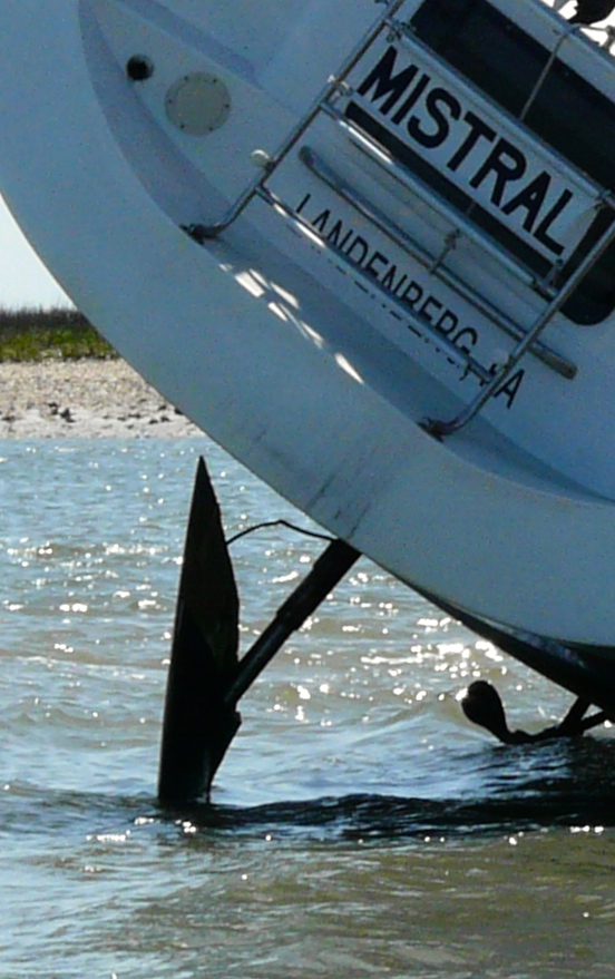
When we ran aground this time, we were about an hour short of low tide. Mistral, the sailboat totally above the water ahead of us, had run up just south of high tide, a much more serious problem. After Rick set our extra anchor, a now familiar task in the ICW, he took off in the dinghy to visit our neighbors-in-distress, offering help if needed. 


David and Barbara were not happy campers, telling Rick about their episode with TowBoatUS earlier in the day. Apparently, the towboat had made the elementary error of attaching its towline to Mistral’s stern, and then trying to haul it off the sandbar sideways. The sailboat’s rudder was just as mired in the sand as her keel, and the predictable result was not only that they failed to free the boat from the shoal, but they also broke the rudder. Now, Dave and Barb are waiting for another towboat to come fetch them once the tide returns. They’ll need to be towed all the way to Savannah, where they will face costly repairs that may take weeks. Our predicament is certainly minor by comparison.


Valkyrie did rise above the water a bit at low tide, and we heeled over some, but it only took a few hours more to bring back the water, and off we floated. All we had to do then was to pull in on the anchor Rick had set hours earlier, and we were well clear of trouble. Unfortunately for Mistral however, their second towboat had not arrived, and the rising water and changing current threatened to strand them even higher up on the shoal. Once the water came back in force, they would have no steering without a rudder, and would be at the mercy of the currents. Rick helped David set his anchor so that at least they would be spared that disaster while they waited for the latest tow.

We finally headed out, hoping to use the last few hours of daylight to get a bit farther north before anchoring for the night. As we pulled past Mistral, David gave us a giant wave from his boat.


There but for the grace …

Saturday, April 14, 2018

Remember These Shores

Good-bye Bahamas. We had a blast. Gorgeous beaches, friendly people, warm climate, and a rum punch or two. We will miss you.


Our Bahamian experience was not totally what we expected, though. Aside from our boat issues, for which the Bahamas cannot be blamed, there were some cultural and geographical dissonances that we did not foresee. For instance, our imagined vision of the Bahamas included lots of palm trees, fronds swaying in the breeze, lining white sand beaches lapped by beautiful blue water. The water was certainly a beautiful shade of aqua, but the palm trees appeared to be imported. We really only saw them clumped around resorts and populated areas. The wild, uninhabited islands had only scrub pines and mangroves, beautiful in their way, but somewhat barren compared to our tropical fantasy.


There were other things that surprised us too, like the weird, almost complete lack of birds. No seagulls, pelicans, or herons, although we did see two or three egrets, and every once in a while, a tern. We’ve been told that there are birds, but they seem to be land birds, so while on the boat we couldn’t see them.

We had both been looking forward to visiting those out-of-the-way islands, finding ourselves alone on an unspoiled island landscape. Never having made it far south to the more isolated islands of the Exumas, we can’t really make a judgment about the whole of the Bahamas. But all of the islands we did visit were plagued with trash. Possibly left there by other boaters, most of it probably washed up on shore from garbage dumps out in the open ocean, the beaches we visited were laden with plastic items; bottles, buckets and other containers. Totally aside from how the sight of all that junk detracted from our aesthetic experience, it was distressing and disappointing to see the direct and ugly consequences of human disregard for our natural environment.
 
Plastic Trash on Great Sale Cay


The weather was also somewhat of a surprise. While it was warm most of the time, there were only a few days that could be called “hot”, and while that is not necessarily a bad thing, there were probably as many days of long sleeves as there were great swimming days. I actually enjoyed this because I could more comfortably cover up from the sun. But it wasn’t what we expected.


Culturally, we had a few instances of disconnect and miscommunication with the locals. The laid-back, “island time” sensibility in the Bahamas is no mere myth, and even though we tried hard to not be ugly American tourists, expecting things to run the way they do back home, we didn’t always succeed. For instance, I had to take a couple of flights home to Baltimore during our Bahamas stay, and after arriving at the tiny airport, I noticed that my flight was listed as “Departed” on the TV monitor. I started to panic because I wasn’t due to leave for another hour. When I rushed over to ask one of the airline attendants about it, she replied, laughing, “Oh, don’t pay any attention to those monitors!”

Another time, while trying to order food at a restaurant counter in Nassau, we carefully looked over their extensive menu displayed on the wall. There was also a list of “Specials” written on a small easel on the counter. We chose one of the specials, but were told that particular dish wasn’t available that day. We chose another of the specials, but again, not available. After a couple more tries, I finally asked what was available. Out of that whole menu, only three items were being served that day, none of them on the “Specials” board. We looked at the people behind the counter in disbelief. They looked at us the same way. We ordered the three things that were available, and even though we clearly didn’t understand the protocol, the meal was delicious.


So what did we like the most about the Bahamas? Rick will miss the swimming, snorkeling and walks on the beach. He loved the extravagantly billowy Caribbean clouds, so different from the often ill-defined smudges so often overhead in Baltimore. I couldn’t get enough of the brilliant aqua-blue water, almost always clear to the bottom, and would sit staring at it for hours. I fell in love with the pastel colored houses, and the big-hearted friendliness of the people. Our stay may not have been completely what we expected, but we still had the time of our lives.


We spent our last week moving steadily up the long arc of the Abaco Islands, stopping at Treasure Cay, Green Turtle Cay, and then the uninhabited Powell and Great Sale Cays before making the hundred-twenty-mile overnight crossing over to Florida and rejoining the ICW. Baltimore, here we come.